
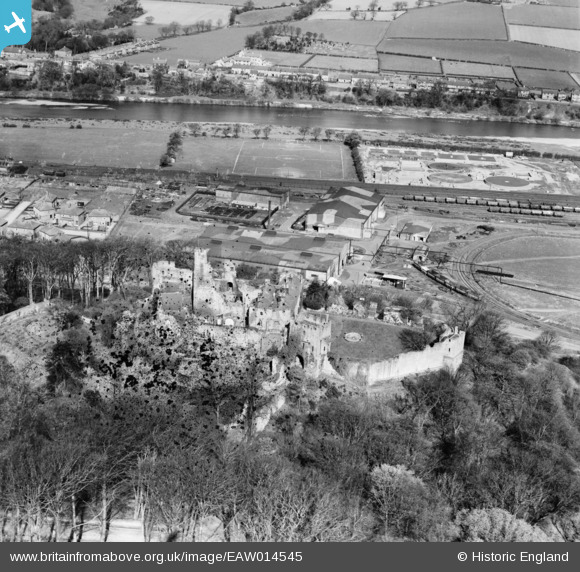
EAW014545 ENGLAND (1948). Prudhoe Castle, Prudhoe, 1948. This image has been produced from a damaged negative.
© Copyright OpenStreetMap contributors and licensed by the OpenStreetMap Foundation. 2026. Cartography is licensed as CC BY-SA.
Nearby Images (3)
EAW014545

EAW014547

EAW014546
 Chemical Works, Prudhoe, 1948. This image has been produced from a damaged negative.")
Details
| Title | [EAW014545] Prudhoe Castle, Prudhoe, 1948. This image has been produced from a damaged negative. |
| Reference | EAW014545 |
| Date | 15-April-1948 |
| Link | |
| Place name | PRUDHOE |
| Parish | PRUDHOE |
| District | |
| Country | ENGLAND |
| Easting / Northing | 409159, 563418 |
| Longitude / Latitude | -1.8569300279075, 54.965228552486 |
| National Grid Reference | NZ092634 |
Pins

redmist |
Friday 22nd of November 2019 11:14:11 AM |