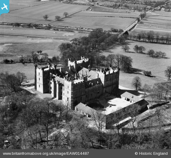
EAW014487 ENGLAND (1948). Lumley Castle, Lumley Castle, 1948
© Copyright OpenStreetMap contributors and licensed by the OpenStreetMap Foundation. 2025. Cartography is licensed as CC BY-SA.
Nearby Images (9)
Details
| Title | [EAW014487] Lumley Castle, Lumley Castle, 1948 |
| Reference | EAW014487 |
| Date | 15-May-1948 |
| Link | |
| Place name | LUMLEY CASTLE |
| Parish | LITTLE LUMLEY |
| District | |
| Country | ENGLAND |
| Easting / Northing | 428771, 551051 |
| Longitude / Latitude | -1.5518202301482, 54.853339159773 |
| National Grid Reference | NZ288511 |
Pins
Be the first to add a comment to this image!


![[EAW014487] Lumley Castle, Lumley Castle, 1948](http://britainfromabove.org.uk/sites/all/libraries/aerofilms-images/public/100x100/EAW/014/EAW014487.jpg)
![[EAW005507] Lumley Castle, Lumley Castle, 1947](http://britainfromabove.org.uk/sites/all/libraries/aerofilms-images/public/100x100/EAW/005/EAW005507.jpg)
![[EAW014486] Lumley Castle, Lumley Castle, 1948](http://britainfromabove.org.uk/sites/all/libraries/aerofilms-images/public/100x100/EAW/014/EAW014486.jpg)
![[EAW005506] Lumley Castle, Lumley Castle, 1947. This image has been produced from a print.](http://britainfromabove.org.uk/sites/all/libraries/aerofilms-images/public/100x100/EAW/005/EAW005506.jpg)
![[EAW014488] Lumley Castle, Lumley Castle, 1948](http://britainfromabove.org.uk/sites/all/libraries/aerofilms-images/public/100x100/EAW/014/EAW014488.jpg)
![[EAW005510] Lumley Castle, Lumley Castle, 1947. This image has been produced from a print.](http://britainfromabove.org.uk/sites/all/libraries/aerofilms-images/public/100x100/EAW/005/EAW005510.jpg)
![[EAW005508] Lumley Castle, Lumley Castle, 1947. This image has been produced from a print.](http://britainfromabove.org.uk/sites/all/libraries/aerofilms-images/public/100x100/EAW/005/EAW005508.jpg)
![[EAW005509] Lumley Castle, Lumley Castle, 1947](http://britainfromabove.org.uk/sites/all/libraries/aerofilms-images/public/100x100/EAW/005/EAW005509.jpg)
![[EAW005511] Lumley Castle, Lumley Castle, 1947. This image has been produced from a print.](http://britainfromabove.org.uk/sites/all/libraries/aerofilms-images/public/100x100/EAW/005/EAW005511.jpg)