
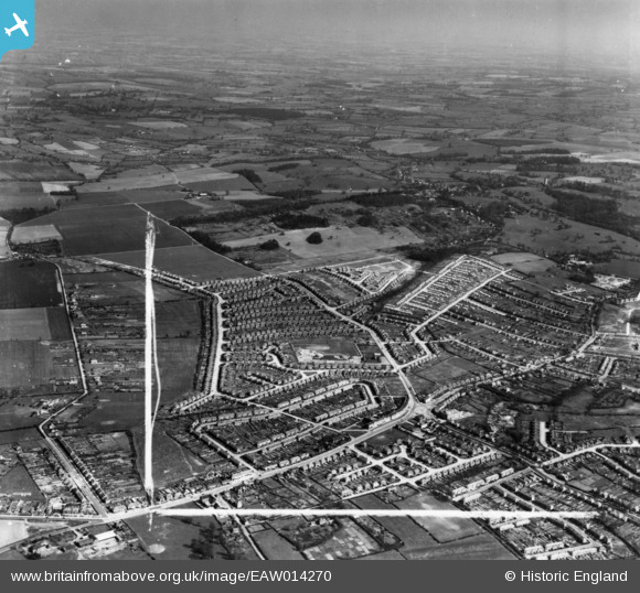
EAW014270 ENGLAND (1948). Clockhouse Lane and the development of Havering Park, Collier Row, from the south-west, 1948. This image has been produced from a print marked by Aerofilms Ltd for photo-editing.
© Copyright OpenStreetMap contributors and licensed by the OpenStreetMap Foundation. 2026. Cartography is licensed as CC BY-SA.
Nearby Images (4)
EAW014270

EAW014271

EAW014273

EAW014269

Details
| Title | [EAW014270] Clockhouse Lane and the development of Havering Park, Collier Row, from the south-west, 1948. This image has been produced from a print marked by Aerofilms Ltd for photo-editing. |
| Reference | EAW014270 |
| Date | 12-April-1948 |
| Link | |
| Place name | COLLIER ROW |
| Parish | |
| District | |
| Country | ENGLAND |
| Easting / Northing | 549842, 191438 |
| Longitude / Latitude | 0.163837238005, 51.601349512835 |
| National Grid Reference | TQ498914 |
Pins

Razerlaff |
Wednesday 12th of November 2014 10:52:18 AM |