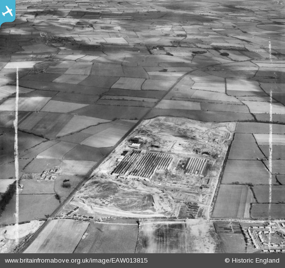
EAW013815 ENGLAND (1948). Construction of Paton and Baldwins Worsted Spinning Mill at Lingfield Point, Lingfield, 1948. This image was marked by Aerofilms Ltd for photo editing.
© Copyright OpenStreetMap contributors and licensed by the OpenStreetMap Foundation. 2026. Cartography is licensed as CC BY-SA.
Nearby Images (5)
Details
| Title | [EAW013815] Construction of Paton and Baldwins Worsted Spinning Mill at Lingfield Point, Lingfield, 1948. This image was marked by Aerofilms Ltd for photo editing. |
| Reference | EAW013815 |
| Date | 16-March-1948 |
| Link | |
| Place name | LINGFIELD |
| Parish | |
| District | |
| Country | ENGLAND |
| Easting / Northing | 432037, 515243 |
| Longitude / Latitude | -1.504879693851, 54.531322177649 |
| National Grid Reference | NZ320152 |
Pins

J May |
Thursday 4th of March 2021 03:01:00 PM | |

J May |
Thursday 4th of March 2021 03:00:34 PM | |

J May |
Thursday 4th of March 2021 03:00:25 PM | |

J May |
Thursday 4th of March 2021 02:59:52 PM | |

J May |
Thursday 4th of March 2021 02:59:17 PM | |

J May |
Thursday 4th of March 2021 02:58:40 PM | |

RichardG |
Tuesday 3rd of July 2018 06:12:51 PM |


![[EAW013815] Construction of Paton and Baldwins Worsted Spinning Mill at Lingfield Point, Lingfield, 1948. This image was marked by Aerofilms Ltd for photo editing.](http://britainfromabove.org.uk/sites/all/libraries/aerofilms-images/public/100x100/EAW/013/EAW013815.jpg)
![[EAW022809] Part of the Patons and Baldwin's Wool Factory under construction at Lingfield Point, Lingfield, 1949](http://britainfromabove.org.uk/sites/all/libraries/aerofilms-images/public/100x100/EAW/022/EAW022809.jpg)
![[EAW022800] Patons and Baldwin's Wool Factory under construction at Lingfield Point, Lingfield, 1949. This image was marked by Aerofilms Ltd for photo editing.](http://britainfromabove.org.uk/sites/all/libraries/aerofilms-images/public/100x100/EAW/022/EAW022800.jpg)
![[EAW027456] Part of the Patons and Baldwins Worsted Spinning Mill under construction, Darlington, from the south-east, 1949. This image was marked by Aerofilms Ltd for photo editing.](http://britainfromabove.org.uk/sites/all/libraries/aerofilms-images/public/100x100/EAW/027/EAW027456.jpg)
![[EAW034275] The Patons and Baldwins Worsted Spinning Mill, Darlington, 1950. This image has been produced from a print marked by Aerofilms Ltd for photo editing.](http://britainfromabove.org.uk/sites/all/libraries/aerofilms-images/public/100x100/EAW/034/EAW034275.jpg)