
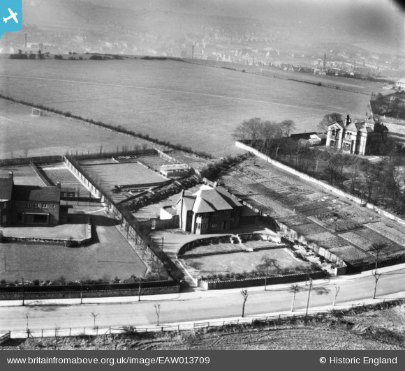
EAW013709 ENGLAND (1948). Houses off Heaton Road, Upper Batley, from the north-east, 1948
© Copyright OpenStreetMap contributors and licensed by the OpenStreetMap Foundation. 2026. Cartography is licensed as CC BY-SA.
Nearby Images (22)
EAW013709

EAW013708

EAW013710

EAW013695

EAW009242

EAW009238

EAW009244

EAW009241

EAW016472

EAW016470

EAW009237

EAW013697

EAW009239

EAW016467

EAW016468

EAW013707

EAW009243

EAW013696

EAW016469

EAW016471

EAW016473

EAW009240

Details
| Title | [EAW013709] Houses off Heaton Road, Upper Batley, from the north-east, 1948 |
| Reference | EAW013709 |
| Date | 11-March-1948 |
| Link | |
| Place name | UPPER BATLEY |
| Parish | |
| District | |
| Country | ENGLAND |
| Easting / Northing | 424405, 425149 |
| Longitude / Latitude | -1.630109987037, 53.721952925436 |
| National Grid Reference | SE244251 |
Pins
Be the first to add a comment to this image!