
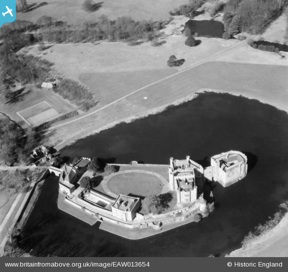
EAW013654 ENGLAND (1948). Leeds Castle, Broomfield, 1948
© Copyright OpenStreetMap contributors and licensed by the OpenStreetMap Foundation. 2026. Cartography is licensed as CC BY-SA.
Nearby Images (18)
EAW013654

EAW004770

EAW004769

EAW013657

EAW004768

EAW013653

EPW009216

EAW017623

EAW004772

EPW009215

EPW038119

EPW018638

EPW038116

EPW038114

EAW013656

EAW004771

EAW013655

EAW004767

Details
| Title | [EAW013654] Leeds Castle, Broomfield, 1948 |
| Reference | EAW013654 |
| Date | 10-March-1948 |
| Link | |
| Place name | BROOMFIELD |
| Parish | BROOMFIELD AND KINGSWOOD |
| District | |
| Country | ENGLAND |
| Easting / Northing | 583563, 153307 |
| Longitude / Latitude | 0.63053515612551, 51.248835765511 |
| National Grid Reference | TQ836533 |
Pins

totoro |
Monday 22nd of May 2017 10:55:10 PM | |
|
totoro |
Monday 22nd of May 2017 10:54:17 PM | |
|
totoro |
Monday 22nd of May 2017 10:53:23 PM | |
|
totoro |
Monday 22nd of May 2017 10:52:27 PM |