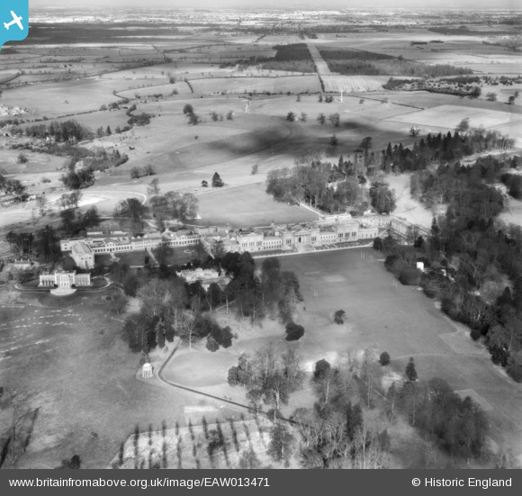
EAW013471 ENGLAND (1948). Stowe School, Stowe Park, from the south, 1948
© Copyright OpenStreetMap contributors and licensed by the OpenStreetMap Foundation. 2025. Cartography is licensed as CC BY-SA.
Nearby Images (7)
Details
| Title | [EAW013471] Stowe School, Stowe Park, from the south, 1948 |
| Reference | EAW013471 |
| Date | 20-February-1948 |
| Link | |
| Place name | STOWE PARK |
| Parish | STOWE |
| District | |
| Country | ENGLAND |
| Easting / Northing | 467467, 237220 |
| Longitude / Latitude | -1.0165013958997, 52.028861397155 |
| National Grid Reference | SP675372 |
Pins

Matt Aldred edob.mattaldred.com |
Friday 8th of March 2024 10:14:18 AM | |

Class31 |
Monday 14th of April 2014 01:52:57 PM | |

PRO |
Wednesday 27th of November 2013 02:42:50 AM | |

PRO |
Wednesday 27th of November 2013 02:40:19 AM |
User Comment Contributions
Stowe House 11/04/2014 |

Class31 |
Monday 14th of April 2014 02:00:50 PM |


![[EAW013471] Stowe School, Stowe Park, from the south, 1948](http://britainfromabove.org.uk/sites/all/libraries/aerofilms-images/public/100x100/EAW/013/EAW013471.jpg)
![[EAW024680] Stowe House (School) and Park, Dadford, from the south-east, 1949](http://britainfromabove.org.uk/sites/all/libraries/aerofilms-images/public/100x100/EAW/024/EAW024680.jpg)
![[EAW024682] Stowe House (School) and Park, Dadford, from the south, 1949](http://britainfromabove.org.uk/sites/all/libraries/aerofilms-images/public/100x100/EAW/024/EAW024682.jpg)
![[EAW013470] Stowe School, Stowe Park, 1948](http://britainfromabove.org.uk/sites/all/libraries/aerofilms-images/public/100x100/EAW/013/EAW013470.jpg)
![[EAW013473] Stowe School, Stowe Park, 1948](http://britainfromabove.org.uk/sites/all/libraries/aerofilms-images/public/100x100/EAW/013/EAW013473.jpg)
![[EAW013472] Stowe School, Stowe Park, 1948](http://britainfromabove.org.uk/sites/all/libraries/aerofilms-images/public/100x100/EAW/013/EAW013472.jpg)
![[EAW024679] Stowe House (School) and St Mary's Church, Dadford, 1949](http://britainfromabove.org.uk/sites/all/libraries/aerofilms-images/public/100x100/EAW/024/EAW024679.jpg)
