
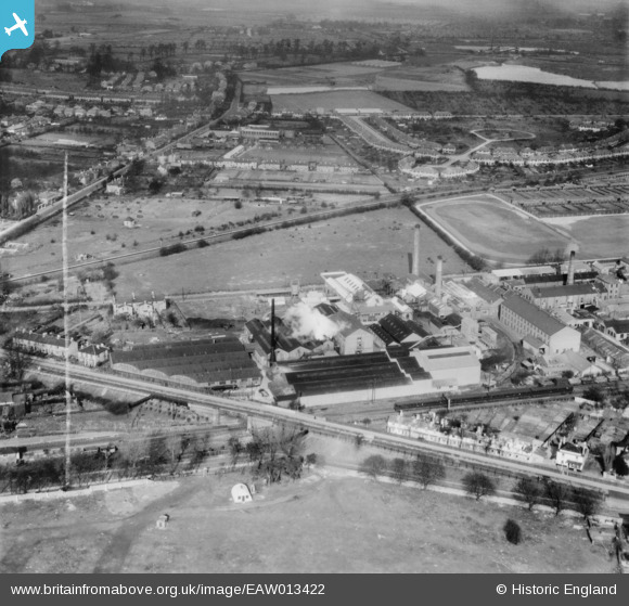
EAW013422 ENGLAND (1948). The P.I.M. Board Company Ltd and environs, Sunbury, from the south, 1948. This image was marked by Aerofilms Ltd for photo editing.
© Copyright OpenStreetMap contributors and licensed by the OpenStreetMap Foundation. 2026. Cartography is licensed as CC BY-SA.
Nearby Images (25)
EAW013422

EAW013414

EAW013415

EAW013416

EAW013423

EAW013202

EAW013200

EAW013195

EAW013419

EAW013417

EAW013205

EAW013420

EAW013412

EAW013201

EAW013413

EAW013196

EAW013424

EAW013194

EAW013203

EAW013198

EAW013411

EAW013204

EAW013421

EAW013197

EAW013199

Details
| Title | [EAW013422] The P.I.M. Board Company Ltd and environs, Sunbury, from the south, 1948. This image was marked by Aerofilms Ltd for photo editing. |
| Reference | EAW013422 |
| Date | 19-February-1948 |
| Link | |
| Place name | SUNBURY |
| Parish | |
| District | |
| Country | ENGLAND |
| Easting / Northing | 510261, 170080 |
| Longitude / Latitude | -0.41414577944566, 51.418504873713 |
| National Grid Reference | TQ103701 |
