
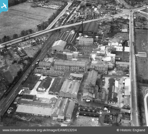
EAW013204 ENGLAND (1948). The P.I.M. Board Company Ltd, Sunbury, 1948
© Copyright OpenStreetMap contributors and licensed by the OpenStreetMap Foundation. 2026. Cartography is licensed as CC BY-SA.
Nearby Images (25)
EAW013204

EAW013196

EAW013424

EAW013421

EAW013201

EAW013417

EAW013200

EAW013419

EAW013203

EAW013195

EAW013413

EAW013205

EAW013202

EAW013423

EAW013416

EAW013412

EAW013194

EAW013422

EAW013414

EAW013198

EAW013411

EAW013415

EAW013199

EAW013420

EAW013197

Details
| Title | [EAW013204] The P.I.M. Board Company Ltd, Sunbury, 1948 |
| Reference | EAW013204 |
| Date | 11-February-1948 |
| Link | |
| Place name | SUNBURY |
| Parish | |
| District | |
| Country | ENGLAND |
| Easting / Northing | 510339, 170185 |
| Longitude / Latitude | -0.4129916943078, 51.41943355746 |
| National Grid Reference | TQ103702 |
Pins

Sparky |
Sunday 15th of October 2017 11:13:52 AM | |
|
Sparky |
Sunday 15th of October 2017 11:13:13 AM | |

Dundee2 |
Saturday 3rd of September 2016 05:53:02 PM | |
|
alan |
Thursday 21st of April 2016 09:42:05 AM |