
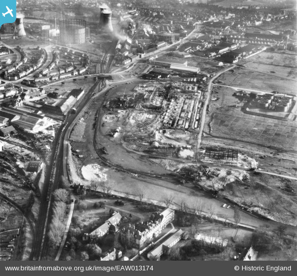
EAW013174 ENGLAND (1948). The Croydon B Power Station under construction, Croydon, 1948
© Copyright OpenStreetMap contributors and licensed by the OpenStreetMap Foundation. 2026. Cartography is licensed as CC BY-SA.
Nearby Images (20)
EAW013174

EAW026596

EAW013172

EAW026600

EAW026597

EAW013173

EAW013176

EAW013171

EAW013178

EAW026598

EAW013177

EAW026588

EAW026590

EAW013182

EAW013183

EAW013175

EAW013180

EAW026589

EAW026595

EAW026591

Details
| Title | [EAW013174] The Croydon B Power Station under construction, Croydon, 1948 |
| Reference | EAW013174 |
| Date | 9-February-1948 |
| Link | |
| Place name | CROYDON |
| Parish | |
| District | |
| Country | ENGLAND |
| Easting / Northing | 530634, 166337 |
| Longitude / Latitude | -0.12266058594459, 51.380534172267 |
| National Grid Reference | TQ306663 |
Pins

Geoff Smith |
Friday 20th of December 2013 03:47:25 PM | |
|
Geoff Smith |
Friday 20th of December 2013 03:43:40 PM | |
|
Geoff Smith |
Friday 20th of December 2013 03:42:50 PM | |
|
Geoff Smith |
Friday 20th of December 2013 03:42:07 PM | |
Geoff, i went to this hospital in the very early 60s when i had scarlet fever & had a faint recollection of where it was, now you have confirmed the location, thanks. |
john bagley |
Friday 23rd of October 2015 02:32:32 PM |
|
Geoff Smith |
Friday 20th of December 2013 03:41:11 PM |