
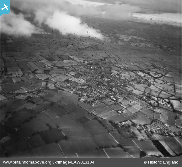
EAW013104 ENGLAND (1948). The village and surrounding countryside, Street, 1948. This image has been produced from a damaged negative.
© Copyright OpenStreetMap contributors and licensed by the OpenStreetMap Foundation. 2026. Cartography is licensed as CC BY-SA.
Nearby Images (4)
EAW013104

EAW012990

EAW012988

EAW013101

Details
| Title | [EAW013104] The village and surrounding countryside, Street, 1948. This image has been produced from a damaged negative. |
| Reference | EAW013104 |
| Date | 21-January-1948 |
| Link | |
| Place name | STREET |
| Parish | STREET |
| District | |
| Country | ENGLAND |
| Easting / Northing | 347944, 136397 |
| Longitude / Latitude | -2.7439193156182, 51.123960738202 |
| National Grid Reference | ST479364 |
Pins

Class31 |
Friday 10th of January 2014 09:18:58 PM |
User Comment Contributions
View looking north east. |
Class31 |
Friday 10th of January 2014 09:19:48 PM |