
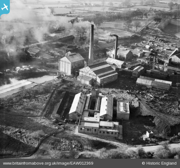
EAW012369 ENGLAND (1947). Baddesley Colliery, Baxterley, 1947
© Copyright OpenStreetMap contributors and licensed by the OpenStreetMap Foundation. 2026. Cartography is licensed as CC BY-SA.
Nearby Images (11)
EAW012369

EAW012370

EAW012365

EPW021029

EAW012368

EAW012364

EAW012366

EAW012367

EAW012363

EAW012361

EAW012362

Details
| Title | [EAW012369] Baddesley Colliery, Baxterley, 1947 |
| Reference | EAW012369 |
| Date | 25-November-1947 |
| Link | |
| Place name | BAXTERLEY |
| Parish | BAXTERLEY |
| District | |
| Country | ENGLAND |
| Easting / Northing | 427968, 297034 |
| Longitude / Latitude | -1.5873005958909, 52.570051275952 |
| National Grid Reference | SP280970 |
Pins

Sparky |
Saturday 30th of September 2017 12:40:35 AM |