
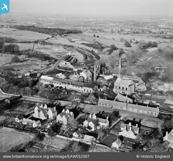
EAW012367 ENGLAND (1947). Baddesley Colliery, Baxterley, from the south, 1947
© Copyright OpenStreetMap contributors and licensed by the OpenStreetMap Foundation. 2026. Cartography is licensed as CC BY-SA.
Nearby Images (10)
EAW012367

EAW012365

EAW012370

EAW012369

EAW012366

EAW012368

EAW012361

EPW021029

EAW012364

EAW012363

Details
| Title | [EAW012367] Baddesley Colliery, Baxterley, from the south, 1947 |
| Reference | EAW012367 |
| Date | 25-November-1947 |
| Link | |
| Place name | BAXTERLEY |
| Parish | BAXTERLEY |
| District | |
| Country | ENGLAND |
| Easting / Northing | 427888, 296928 |
| Longitude / Latitude | -1.5884899737801, 52.5691023764 |
| National Grid Reference | SP279969 |
Pins
Be the first to add a comment to this image!