
Downtime message
Due to planned maintenance taking place on Thursday 9th October between 9:00 AM and 1:00 PM, services might be disrupted or temporarily unavailable. We apologise for any inconvenience.
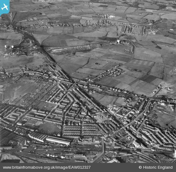
EAW012327 ENGLAND (1947). The town, Earlestown, 1947. This image has been produced from a print.
© Copyright OpenStreetMap contributors and licensed by the OpenStreetMap Foundation. 2025. Cartography is licensed as CC BY-SA.
Nearby Images (3)
EAW012327

EAW012342

EAW012343

Details
| Title | [EAW012327] The town, Earlestown, 1947. This image has been produced from a print. |
| Reference | EAW012327 |
| Date | 26-November-1947 |
| Link | |
| Place name | EARLESTOWN |
| Parish | |
| District | |
| Country | ENGLAND |
| Easting / Northing | 357210, 395777 |
| Longitude / Latitude | -2.6444938146433, 53.456751176745 |
| National Grid Reference | SJ572958 |
Pins

cptpies |
Tuesday 7th of July 2020 09:11:12 AM |