
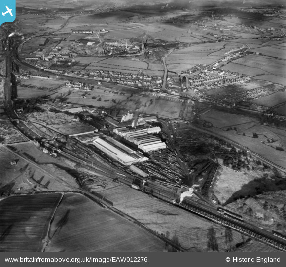
EAW012276 ENGLAND (1947). Codnor Park Iron Works and environs, Codnor Park, 1947
© Copyright OpenStreetMap contributors and licensed by the OpenStreetMap Foundation. 2026. Cartography is licensed as CC BY-SA.
Nearby Images (16)
EAW012276

EAW012268

EPW050240

EPW050243

EPW050241

EAW012269

EAW012272

EPW050242

EAW012267

EAW012273

EAW012266

EPW050244

EAW012274

EAW012271

EAW012275

EAW012270

Details
| Title | [EAW012276] Codnor Park Iron Works and environs, Codnor Park, 1947 |
| Reference | EAW012276 |
| Date | 24-November-1947 |
| Link | |
| Place name | CODNOR PARK |
| Parish | IRONVILLE |
| District | |
| Country | ENGLAND |
| Easting / Northing | 444280, 351314 |
| Longitude / Latitude | -1.3392542042795, 53.056940112502 |
| National Grid Reference | SK443513 |
Pins

John Wass |
Tuesday 13th of January 2015 09:18:38 PM |
User Comment Contributions
From the movement of the 8F on a coal empties train heading north crossing from the fast lines to the slow lines the photos are in reverse order, 12276 is the first photo and 12265 is the last with the plane circling anti-clockwise twice |
Les Gregory |
Saturday 14th of March 2015 02:32:55 PM |