
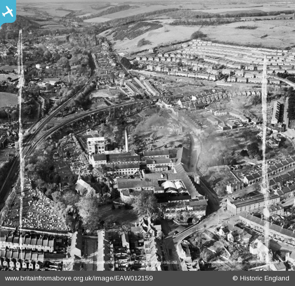
EAW012159 ENGLAND (1947). Buckland Paper Mill and environs, Buckland, 1947. This image was marked by Aerofilms Ltd for photo editing.
© Copyright OpenStreetMap contributors and licensed by the OpenStreetMap Foundation. 2026. Cartography is licensed as CC BY-SA.
Nearby Images (11)
EAW012159

EAW012158

EAW012163

EAW012161

EAW012160

EAW012162

EPW038166

EAW012164

EPW038164

EPW038165

EAW012165

Details
| Title | [EAW012159] Buckland Paper Mill and environs, Buckland, 1947. This image was marked by Aerofilms Ltd for photo editing. |
| Reference | EAW012159 |
| Date | 10-November-1947 |
| Link | |
| Place name | BUCKLAND |
| Parish | DOVER |
| District | |
| Country | ENGLAND |
| Easting / Northing | 630367, 142915 |
| Longitude / Latitude | 1.2935204625541, 51.138556062505 |
| National Grid Reference | TR304429 |
Pins

MB |
Wednesday 21st of September 2016 10:43:29 AM | |
|
MB |
Wednesday 21st of September 2016 10:43:00 AM | |
|
MB |
Wednesday 21st of September 2016 10:42:03 AM | |
|
MB |
Wednesday 21st of September 2016 10:41:30 AM | |
|
MB |
Wednesday 21st of September 2016 10:40:37 AM | |
|
MB |
Wednesday 21st of September 2016 10:38:59 AM | |
|
MB |
Wednesday 21st of September 2016 10:38:23 AM | |
|
Stubzi34 |
Tuesday 9th of August 2016 04:07:31 PM | |
|
Stubzi34 |
Thursday 4th of September 2014 02:38:35 PM | |
|
ATC |
Monday 6th of January 2014 01:13:53 PM | |
|
cptpies |
Thursday 28th of November 2013 10:33:35 AM |
User Comment Contributions
Anti Tank Blocks, Buckland. |
cptpies |
Thursday 19th of December 2013 03:22:29 PM |