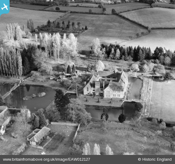
EAW012127 ENGLAND (1947). Brinsop Court, Brinsop, 1947
© Copyright OpenStreetMap contributors and licensed by the OpenStreetMap Foundation. 2025. Cartography is licensed as CC BY-SA.
Nearby Images (9)
Details
| Title | [EAW012127] Brinsop Court, Brinsop, 1947 |
| Reference | EAW012127 |
| Date | 5-November-1947 |
| Link | |
| Place name | BRINSOP |
| Parish | BRINSOP AND WORMSLEY |
| District | |
| Country | ENGLAND |
| Easting / Northing | 344602, 245796 |
| Longitude / Latitude | -2.808976236603, 52.107303086183 |
| National Grid Reference | SO446458 |
Pins
Be the first to add a comment to this image!


![[EAW012127] Brinsop Court, Brinsop, 1947](http://britainfromabove.org.uk/sites/all/libraries/aerofilms-images/public/100x100/EAW/012/EAW012127.jpg)
![[EAW012123] Brinsop Court, Brinsop, 1947](http://britainfromabove.org.uk/sites/all/libraries/aerofilms-images/public/100x100/EAW/012/EAW012123.jpg)
![[EAW012124] Brinsop Court, Brinsop, 1947](http://britainfromabove.org.uk/sites/all/libraries/aerofilms-images/public/100x100/EAW/012/EAW012124.jpg)
![[EAW012137] Brinsop Court, Brinsop, 1947](http://britainfromabove.org.uk/sites/all/libraries/aerofilms-images/public/100x100/EAW/012/EAW012137.jpg)
![[EAW012121] Brinsop Court, Brinsop, 1947](http://britainfromabove.org.uk/sites/all/libraries/aerofilms-images/public/100x100/EAW/012/EAW012121.jpg)
![[EAW012126] Brinsop Court, Brinsop, 1947](http://britainfromabove.org.uk/sites/all/libraries/aerofilms-images/public/100x100/EAW/012/EAW012126.jpg)
![[EAW012128] Brinsop Court, Brinsop, 1947](http://britainfromabove.org.uk/sites/all/libraries/aerofilms-images/public/100x100/EAW/012/EAW012128.jpg)
![[EAW012122] Brinsop Court, Brinsop, 1947](http://britainfromabove.org.uk/sites/all/libraries/aerofilms-images/public/100x100/EAW/012/EAW012122.jpg)
![[EAW012125] Brinsop Court and Sally Coppice, Brinsop, 1947](http://britainfromabove.org.uk/sites/all/libraries/aerofilms-images/public/100x100/EAW/012/EAW012125.jpg)