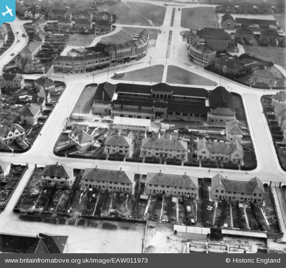
EAW011973 ENGLAND (1947). Connaught Road, the Filwood Social Centre and Filwood Broadway, Filwood Park, 1947
© Copyright OpenStreetMap contributors and licensed by the OpenStreetMap Foundation. 2026. Cartography is licensed as CC BY-SA.
Nearby Images (9)
Details
| Title | [EAW011973] Connaught Road, the Filwood Social Centre and Filwood Broadway, Filwood Park, 1947 |
| Reference | EAW011973 |
| Date | 1-November-1947 |
| Link | |
| Place name | FILWOOD PARK |
| Parish | |
| District | |
| Country | ENGLAND |
| Easting / Northing | 359366, 169828 |
| Longitude / Latitude | -2.5845029384898, 51.425509610436 |
| National Grid Reference | ST594698 |
Pins

Sparky |
Sunday 1st of October 2017 09:14:23 AM | |

Class31 |
Wednesday 26th of February 2014 11:51:27 PM | |

Class31 |
Wednesday 26th of February 2014 11:50:46 PM | |

Class31 |
Wednesday 26th of February 2014 11:50:20 PM | |

Class31 |
Wednesday 26th of February 2014 11:49:35 PM |
User Comment Contributions
View looking south. |

Class31 |
Wednesday 26th of February 2014 11:51:53 PM |


![[EAW011973] Connaught Road, the Filwood Social Centre and Filwood Broadway, Filwood Park, 1947](http://britainfromabove.org.uk/sites/all/libraries/aerofilms-images/public/100x100/EAW/011/EAW011973.jpg)
![[EAW011970] The Filwood Social Centre and surrounding streets, Filwood Park, 1947](http://britainfromabove.org.uk/sites/all/libraries/aerofilms-images/public/100x100/EAW/011/EAW011970.jpg)
![[EAW011968] The Filwood Social Centre and surrounding streets, Filwood Park, 1947](http://britainfromabove.org.uk/sites/all/libraries/aerofilms-images/public/100x100/EAW/011/EAW011968.jpg)
![[EAW011967] The Filwood Social Centre and surrounding streets, Filwood Park, 1947](http://britainfromabove.org.uk/sites/all/libraries/aerofilms-images/public/100x100/EAW/011/EAW011967.jpg)
![[EAW011971] The Filwood Social Centre, Filwood Park, 1947](http://britainfromabove.org.uk/sites/all/libraries/aerofilms-images/public/100x100/EAW/011/EAW011971.jpg)
![[EAW011974] The Filwood Social Centre and environs, Filwood Park, from the south-east, 1947](http://britainfromabove.org.uk/sites/all/libraries/aerofilms-images/public/100x100/EAW/011/EAW011974.jpg)
![[EAW011966] The Filwood Social Centre and surrounding streets, Filwood Park, 1947](http://britainfromabove.org.uk/sites/all/libraries/aerofilms-images/public/100x100/EAW/011/EAW011966.jpg)
![[EAW011972] The Filwood Social Centre and environs, Filwood Park, from the south-east, 1947](http://britainfromabove.org.uk/sites/all/libraries/aerofilms-images/public/100x100/EAW/011/EAW011972.jpg)
![[EAW011969] The Filwood Social Centre and Filwood Broadway, Filwood Park, 1947](http://britainfromabove.org.uk/sites/all/libraries/aerofilms-images/public/100x100/EAW/011/EAW011969.jpg)