
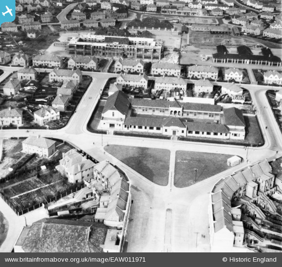
EAW011971 ENGLAND (1947). The Filwood Social Centre, Filwood Park, 1947
© Copyright OpenStreetMap contributors and licensed by the OpenStreetMap Foundation. 2026. Cartography is licensed as CC BY-SA.
Nearby Images (9)
EAW011971

EAW011974

EAW011968

EAW011967

EAW011970

EAW011966

EAW011973

EAW011972

EAW011969

Details
| Title | [EAW011971] The Filwood Social Centre, Filwood Park, 1947 |
| Reference | EAW011971 |
| Date | 1-November-1947 |
| Link | |
| Place name | FILWOOD PARK |
| Parish | |
| District | |
| Country | ENGLAND |
| Easting / Northing | 359344, 169780 |
| Longitude / Latitude | -2.5848138719225, 51.425076408836 |
| National Grid Reference | ST593698 |
Pins

Matt Aldred edob.mattaldred.com |
Sunday 28th of June 2026 06:10:31 PM | |

Class31 |
Thursday 27th of February 2014 09:57:34 AM | |
|
Class31 |
Thursday 27th of February 2014 09:56:58 AM | |
|
Class31 |
Thursday 27th of February 2014 09:56:18 AM | |
|
Class31 |
Thursday 27th of February 2014 09:54:23 AM | |
|
Class31 |
Thursday 27th of February 2014 09:53:45 AM | |
|
Class31 |
Thursday 27th of February 2014 09:53:25 AM | |
|
Class31 |
Thursday 27th of February 2014 09:53:02 AM | |
|
Class31 |
Thursday 27th of February 2014 09:52:44 AM | |
|
Class31 |
Thursday 27th of February 2014 09:52:19 AM |
