
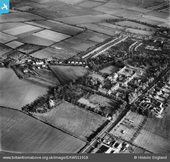
EAW011918 ENGLAND (1947). Girton College and the surrounding area, Girton, 1947
© Copyright OpenStreetMap contributors and licensed by the OpenStreetMap Foundation. 2026. Cartography is licensed as CC BY-SA.
Nearby Images (16)
EAW011918

EAW011917

EPW000041

EPW000048

EAW011925

EAW011920

EAW011921

EAW011916
 and the surrounding residential area, Girton, 1947")
EAW011927

EAW011928

EAW011923

EAW011922

EAW011924

EAW011926

EAW011915

EAW011929

Details
| Title | [EAW011918] Girton College and the surrounding area, Girton, 1947 |
| Reference | EAW011918 |
| Date | 15-October-1947 |
| Link | |
| Place name | GIRTON |
| Parish | GIRTON |
| District | |
| Country | ENGLAND |
| Easting / Northing | 542436, 261138 |
| Longitude / Latitude | 0.085799019352726, 52.229594892551 |
| National Grid Reference | TL424611 |
Pins
Be the first to add a comment to this image!