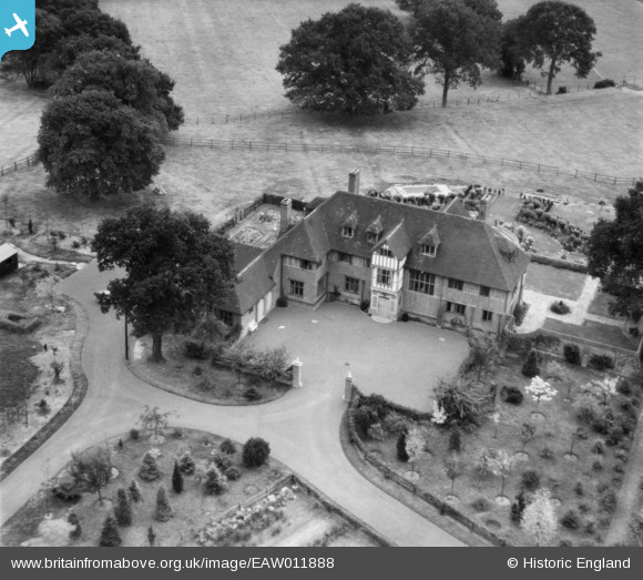
EAW011888 ENGLAND (1947). Valley Wood Place, Chobham, 1947
© Copyright OpenStreetMap contributors and licensed by the OpenStreetMap Foundation. 2025. Cartography is licensed as CC BY-SA.
Nearby Images (7)
Details
| Title | [EAW011888] Valley Wood Place, Chobham, 1947 |
| Reference | EAW011888 |
| Date | 9-October-1947 |
| Link | |
| Place name | CHOBHAM |
| Parish | CHOBHAM |
| District | |
| Country | ENGLAND |
| Easting / Northing | 496100, 163939 |
| Longitude / Latitude | -0.61941423403312, 51.36587516423 |
| National Grid Reference | SU961639 |
Pins
Be the first to add a comment to this image!


![[EAW011888] Valley Wood Place, Chobham, 1947](http://britainfromabove.org.uk/sites/all/libraries/aerofilms-images/public/100x100/EAW/011/EAW011888.jpg)
![[EAW011887] Valley Wood Place, Chobham, 1947](http://britainfromabove.org.uk/sites/all/libraries/aerofilms-images/public/100x100/EAW/011/EAW011887.jpg)
![[EAW008954] Valley Wood Place, Chobham, 1947](http://britainfromabove.org.uk/sites/all/libraries/aerofilms-images/public/100x100/EAW/008/EAW008954.jpg)
![[EAW008953] Valley Wood Place, Chobham, 1947](http://britainfromabove.org.uk/sites/all/libraries/aerofilms-images/public/100x100/EAW/008/EAW008953.jpg)
![[EAW011886] Valley Wood Place, Chobham, 1947](http://britainfromabove.org.uk/sites/all/libraries/aerofilms-images/public/100x100/EAW/011/EAW011886.jpg)
![[EAW008951] Valley Wood Place and the surrounding countryside, Chobham, 1947](http://britainfromabove.org.uk/sites/all/libraries/aerofilms-images/public/100x100/EAW/008/EAW008951.jpg)
![[EAW008952] Valley Wood Place and the surrounding countryside, Chobham, from the south-west, 1947](http://britainfromabove.org.uk/sites/all/libraries/aerofilms-images/public/100x100/EAW/008/EAW008952.jpg)