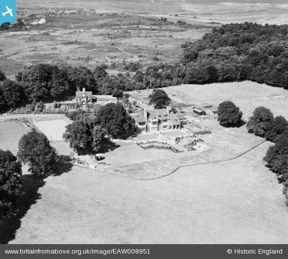
EAW008951 ENGLAND (1947). Valley Wood Place and the surrounding countryside, Chobham, 1947
© Copyright OpenStreetMap contributors and licensed by the OpenStreetMap Foundation. 2024. Cartography is licensed as CC BY-SA.
Nearby Images (8)
Details
| Title | [EAW008951] Valley Wood Place and the surrounding countryside, Chobham, 1947 |
| Reference | EAW008951 |
| Date | 12-August-1947 |
| Link | |
| Place name | CHOBHAM |
| Parish | CHOBHAM |
| District | |
| Country | ENGLAND |
| Easting / Northing | 496086, 163930 |
| Longitude / Latitude | -0.61961773024829, 51.36579662262 |
| National Grid Reference | SU961639 |


![[EAW008951] Valley Wood Place and the surrounding countryside, Chobham, 1947](http://britainfromabove.org.uk/sites/all/libraries/aerofilms-images/public/100x100/EAW/008/EAW008951.jpg)
![[EAW011887] Valley Wood Place, Chobham, 1947](http://britainfromabove.org.uk/sites/all/libraries/aerofilms-images/public/100x100/EAW/011/EAW011887.jpg)
![[EAW011888] Valley Wood Place, Chobham, 1947](http://britainfromabove.org.uk/sites/all/libraries/aerofilms-images/public/100x100/EAW/011/EAW011888.jpg)
![[EAW008954] Valley Wood Place, Chobham, 1947](http://britainfromabove.org.uk/sites/all/libraries/aerofilms-images/public/100x100/EAW/008/EAW008954.jpg)
![[EAW011886] Valley Wood Place, Chobham, 1947](http://britainfromabove.org.uk/sites/all/libraries/aerofilms-images/public/100x100/EAW/011/EAW011886.jpg)
![[EAW008953] Valley Wood Place, Chobham, 1947](http://britainfromabove.org.uk/sites/all/libraries/aerofilms-images/public/100x100/EAW/008/EAW008953.jpg)
![[EAW008952] Valley Wood Place and the surrounding countryside, Chobham, from the south-west, 1947](http://britainfromabove.org.uk/sites/all/libraries/aerofilms-images/public/100x100/EAW/008/EAW008952.jpg)
![[EAW008948] Valley Wood Place between Chobham Place Wood and Russell Hill, Chobham, 1947](http://britainfromabove.org.uk/sites/all/libraries/aerofilms-images/public/100x100/EAW/008/EAW008948.jpg)
