
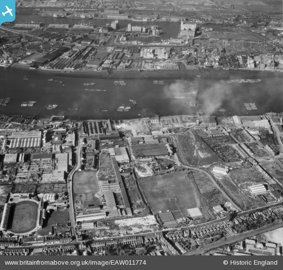
EAW011774 ENGLAND (1947). J. Stone and Company Limited Foundry and environs, New Charlton, 1947
© Copyright OpenStreetMap contributors and licensed by the OpenStreetMap Foundation. 2026. Cartography is licensed as CC BY-SA.
Nearby Images (7)
EAW011774

EAW011770

EAW011773

EAW011775

EAW011771

EAW011768

EAW011769

Details
| Title | [EAW011774] J. Stone and Company Limited Foundry and environs, New Charlton, 1947 |
| Reference | EAW011774 |
| Date | 9-October-1947 |
| Link | |
| Place name | NEW CHARLTON |
| Parish | |
| District | |
| Country | ENGLAND |
| Easting / Northing | 541192, 179128 |
| Longitude / Latitude | 0.03407093323762, 51.492957999005 |
| National Grid Reference | TQ412791 |
Pins

John W |
Tuesday 9th of August 2016 08:37:43 PM | |
|
John W |
Tuesday 9th of August 2016 08:28:16 PM | |
|
John W |
Tuesday 9th of August 2016 08:27:17 PM | |
|
John W |
Tuesday 9th of August 2016 08:25:53 PM | |
|
John W |
Tuesday 9th of August 2016 08:23:32 PM | |
|
terry |
Tuesday 26th of June 2012 12:59:27 PM |
User Comment Contributions
Note the areas of clear ground towards the top right of the picture, particularly between Silvertown Way and the Royal Victoria Dock - the result of severe bombing in this area during WW2. |
John W |
Tuesday 9th of August 2016 08:33:02 PM |