
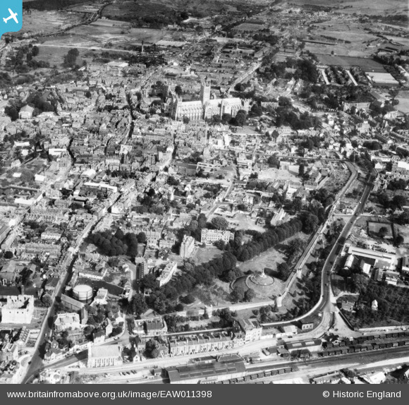
EAW011398 ENGLAND (1947). Christ Church Cathedral and the city centre, Canterbury, from the south-west, 1947
© Copyright OpenStreetMap contributors and licensed by the OpenStreetMap Foundation. 2026. Cartography is licensed as CC BY-SA.
Nearby Images (4)
EAW011398

EPW000394

EPW013269

EAW004802

Details
| Title | [EAW011398] Christ Church Cathedral and the city centre, Canterbury, from the south-west, 1947 |
| Reference | EAW011398 |
| Date | 1-October-1947 |
| Link | |
| Place name | CANTERBURY |
| Parish | |
| District | |
| Country | ENGLAND |
| Easting / Northing | 614738, 157410 |
| Longitude / Latitude | 1.0791078480008, 51.274796271689 |
| National Grid Reference | TR147574 |
Pins

Matt Aldred edob.mattaldred.com |
Tuesday 23rd of February 2021 03:28:51 PM | |
|
Matt Aldred edob.mattaldred.com |
Tuesday 23rd of February 2021 03:27:04 PM | |

Sparky |
Sunday 1st of October 2017 02:24:59 PM | |
|
Sparky |
Thursday 24th of August 2017 12:17:00 AM | |

Alan McFaden |
Thursday 10th of July 2014 02:02:13 PM | |
|
Alan McFaden |
Thursday 10th of July 2014 02:01:43 PM | |
|
Alan McFaden |
Thursday 10th of July 2014 02:00:52 PM | |
|
Alan McFaden |
Thursday 10th of July 2014 01:59:56 PM | |
|
Alan McFaden |
Thursday 10th of July 2014 01:59:04 PM |


