
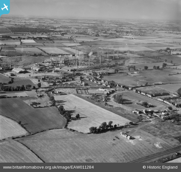
EAW011284 ENGLAND (1947). The London Brick Company Stewartby Brickworks and environs, Stewartby, from the south-east, 1947
© Copyright OpenStreetMap contributors and licensed by the OpenStreetMap Foundation. 2026. Cartography is licensed as CC BY-SA.
Nearby Images (4)
EAW011284

EPW054970

EPW054979

EPW049656

Details
| Title | [EAW011284] The London Brick Company Stewartby Brickworks and environs, Stewartby, from the south-east, 1947 |
| Reference | EAW011284 |
| Date | 30-September-1947 |
| Link | |
| Place name | STEWARTBY |
| Parish | STEWARTBY |
| District | |
| Country | ENGLAND |
| Easting / Northing | 502131, 241946 |
| Longitude / Latitude | -0.50992853987145, 52.066041363186 |
| National Grid Reference | TL021419 |
Pins

melgibbs |
Thursday 9th of January 2014 09:19:23 AM | |
|
melgibbs |
Thursday 9th of January 2014 09:16:01 AM | |
|
melgibbs |
Wednesday 8th of January 2014 09:09:22 PM | |
|
melgibbs |
Wednesday 8th of January 2014 09:08:33 PM | |
|
melgibbs |
Wednesday 8th of January 2014 09:08:05 PM | |
|
melgibbs |
Wednesday 8th of January 2014 09:07:45 PM |
User Comment Contributions
For more details on the brickworks, see www.bedfordshire.gov.uk/CommunityAndLiving/ArchivesAndRecordOffice/CommunityArchives/Stewartby/LondonBrickCompanyInStewartby.aspx. |
melgibbs |
Thursday 9th of January 2014 09:20:10 AM |