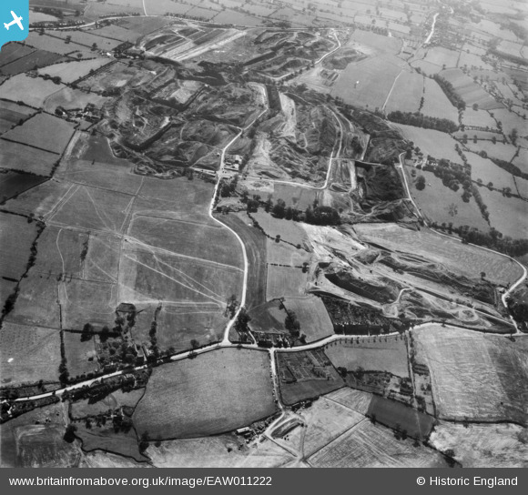
EAW011222 ENGLAND (1947). Denby Lane, Dumbles Lane and opencast coal mining to the east of Flamstead House, Denby Village, 1947
© Copyright OpenStreetMap contributors and licensed by the OpenStreetMap Foundation. 2024. Cartography is licensed as CC BY-SA.
Details
| Title | [EAW011222] Denby Lane, Dumbles Lane and opencast coal mining to the east of Flamstead House, Denby Village, 1947 |
| Reference | EAW011222 |
| Date | 30-September-1947 |
| Link | |
| Place name | DENBY VILLAGE |
| Parish | DENBY |
| District | |
| Country | ENGLAND |
| Easting / Northing | 440851, 346652 |
| Longitude / Latitude | -1.3910092078188, 53.015303471843 |
| National Grid Reference | SK409467 |


![[EAW011222] Denby Lane, Dumbles Lane and opencast coal mining to the east of Flamstead House, Denby Village, 1947](http://britainfromabove.org.uk/sites/all/libraries/aerofilms-images/public/100x100/EAW/011/EAW011222.jpg)
![[EAW011245] Opencast coal mining to the south of High Bank, Denby Village, 1947](http://britainfromabove.org.uk/sites/all/libraries/aerofilms-images/public/100x100/EAW/011/EAW011245.jpg)
