
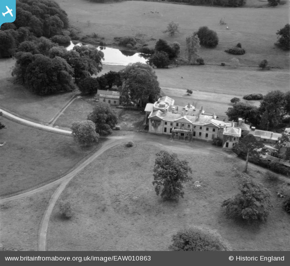
EAW010863 ENGLAND (1947). Buckland House and St Mary's Church, Buckland Filleigh, 1947
© Copyright OpenStreetMap contributors and licensed by the OpenStreetMap Foundation. 2026. Cartography is licensed as CC BY-SA.
Nearby Images (8)
EAW010863

EAW010859

EAW010861

EAW010862

EAW010865

EAW010860

EAW010864

EAW010857

Details
| Title | [EAW010863] Buckland House and St Mary's Church, Buckland Filleigh, 1947 |
| Reference | EAW010863 |
| Date | 20-September-1947 |
| Link | |
| Place name | BUCKLAND FILLEIGH |
| Parish | BUCKLAND FILLEIGH |
| District | |
| Country | ENGLAND |
| Easting / Northing | 246522, 109174 |
| Longitude / Latitude | -4.1810555251213, 50.861121753013 |
| National Grid Reference | SS465092 |
Pins
Be the first to add a comment to this image!
User Comment Contributions
Now a place for wedding venues and weekend parties: www.landedhouses.co.uk/england/devon-cornwall/buckland-house/ |

MB |
Saturday 23rd of November 2013 11:31:55 PM |