
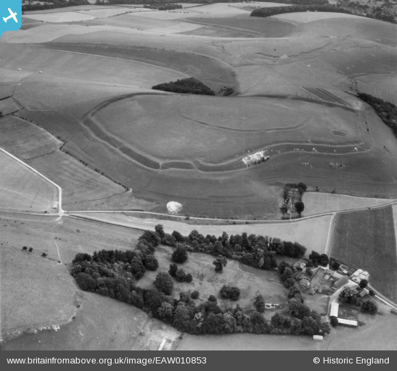
EAW010853 ENGLAND (1947). Scratchbury Hillfort and Middleton Farm, Scratchbury Hill, 1947
© Copyright OpenStreetMap contributors and licensed by the OpenStreetMap Foundation. 2026. Cartography is licensed as CC BY-SA.
Nearby Images (2)
EAW010853

EAW010854

Details
| Title | [EAW010853] Scratchbury Hillfort and Middleton Farm, Scratchbury Hill, 1947 |
| Reference | EAW010853 |
| Date | 17-September-1947 |
| Link | |
| Place name | SCRATCHBURY HILL |
| Parish | NORTON BAVANT |
| District | |
| Country | ENGLAND |
| Easting / Northing | 390987, 144444 |
| Longitude / Latitude | -2.1290098770919, 51.198622563885 |
| National Grid Reference | ST910444 |
Pins
User Comment Contributions
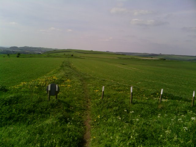
View north west from Cotley Hill towards Scratchbury 04/05/2014 |

Class31 |
Monday 5th of May 2014 06:56:02 PM |
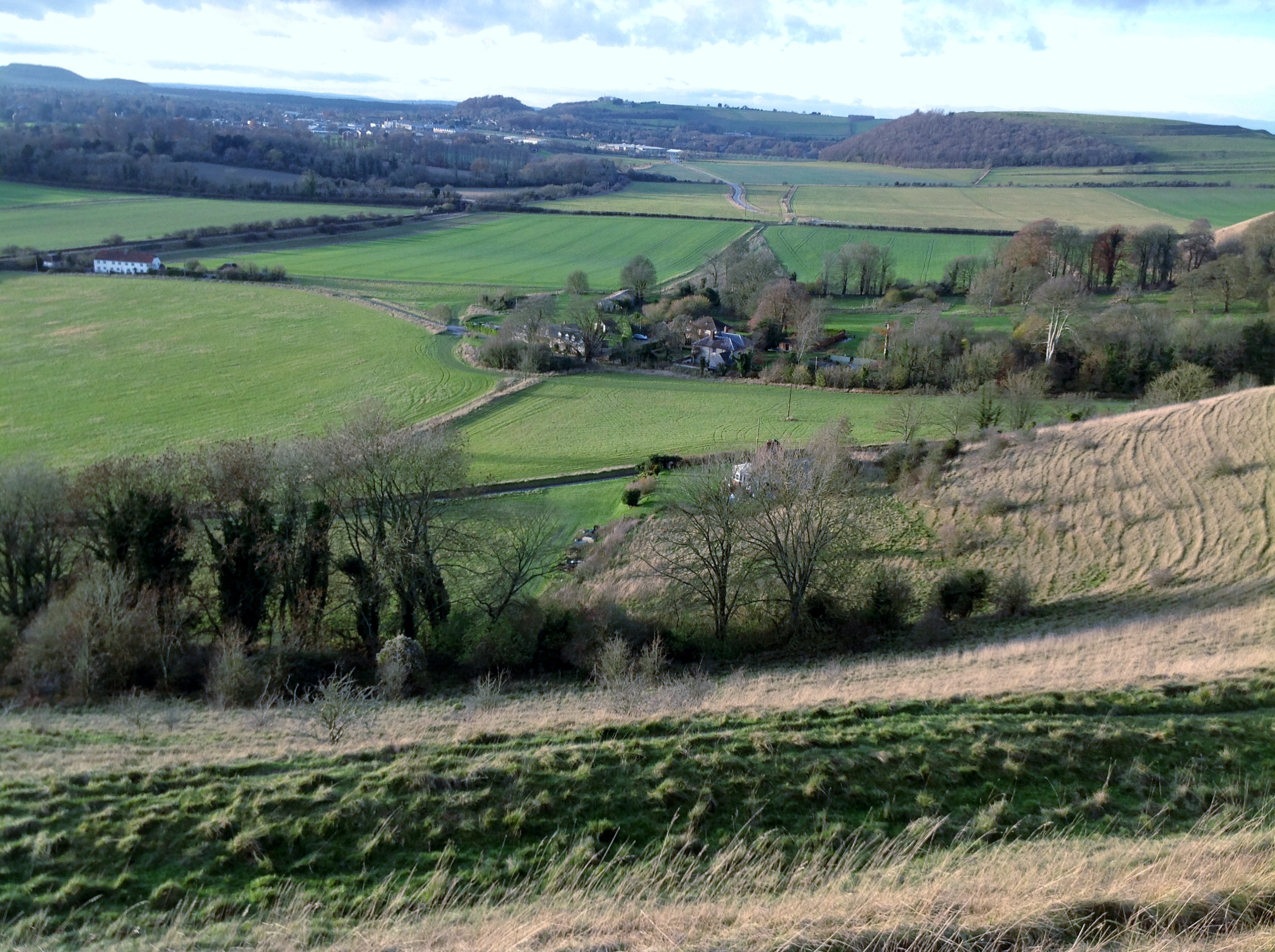
Looking north from Scratchbury Hill towards Middleton Farm 08/12/2013 15.04hrs |
Class31 |
Sunday 8th of December 2013 03:59:25 PM |
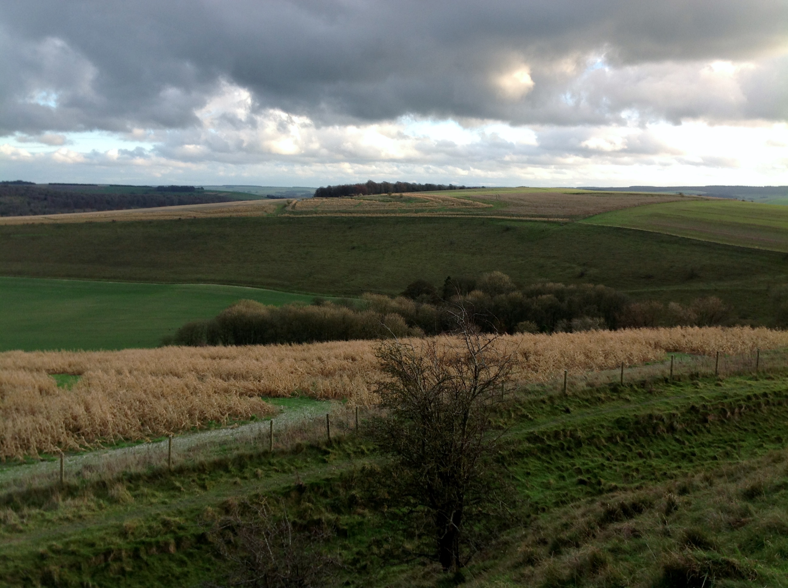
Looking south east from Scratchbury Hill over The Copse towards Cotley Hill 08/12/2013 14.46hrs |
Class31 |
Sunday 8th of December 2013 03:52:45 PM |
View looking south east. |
Class31 |
Sunday 8th of December 2013 09:40:07 AM |