
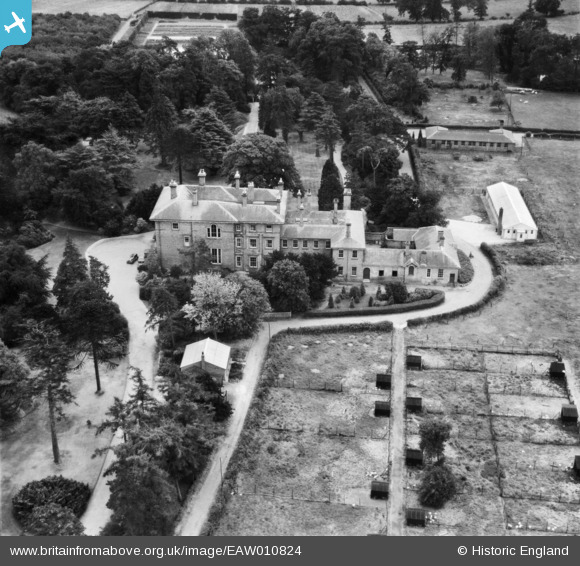
EAW010824 ENGLAND (1947). Rodbaston Hall (Staffordshire Farm Institute), Penkridge, 1947
© Copyright OpenStreetMap contributors and licensed by the OpenStreetMap Foundation. 2026. Cartography is licensed as CC BY-SA.
Nearby Images (9)
EAW010824
, Penkridge, 1947")
EAW010827
, Penkridge, 1947")
EAW010823
, Penkridge, 1947")
EAW010825
, Penkridge, 1947")
EAW010822
, Penkridge, 1947")
EAW010826
, Penkridge, 1947")
EAW010820
, Penkridge, 1947")
EAW010821
, Penkridge, 1947")
EAW010819
, Penkridge, 1947")
Details
| Title | [EAW010824] Rodbaston Hall (Staffordshire Farm Institute), Penkridge, 1947 |
| Reference | EAW010824 |
| Date | 17-September-1947 |
| Link | |
| Place name | PENKRIDGE |
| Parish | PENKRIDGE |
| District | |
| Country | ENGLAND |
| Easting / Northing | 392191, 311644 |
| Longitude / Latitude | -2.1155777577368, 52.702069240398 |
| National Grid Reference | SJ922116 |
Pins
Be the first to add a comment to this image!