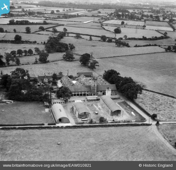
EAW010821 ENGLAND (1947). Rodbaston Hall Farm (Staffordshire Farm Institute), Penkridge, 1947
© Copyright OpenStreetMap contributors and licensed by the OpenStreetMap Foundation. 2025. Cartography is licensed as CC BY-SA.
Nearby Images (9)
Details
| Title | [EAW010821] Rodbaston Hall Farm (Staffordshire Farm Institute), Penkridge, 1947 |
| Reference | EAW010821 |
| Date | 17-September-1947 |
| Link | |
| Place name | PENKRIDGE |
| Parish | PENKRIDGE |
| District | |
| Country | ENGLAND |
| Easting / Northing | 392078, 311409 |
| Longitude / Latitude | -2.1172445581887, 52.699954794999 |
| National Grid Reference | SJ921114 |
Pins
Be the first to add a comment to this image!


![[EAW010821] Rodbaston Hall Farm (Staffordshire Farm Institute), Penkridge, 1947](http://britainfromabove.org.uk/sites/all/libraries/aerofilms-images/public/100x100/EAW/010/EAW010821.jpg)
![[EAW010819] Rodbaston Hall Farm (Staffordshire Farm Institute), Penkridge, 1947](http://britainfromabove.org.uk/sites/all/libraries/aerofilms-images/public/100x100/EAW/010/EAW010819.jpg)
![[EAW010820] Rodbaston Hall Farm (Staffordshire Farm Institute), Penkridge, 1947](http://britainfromabove.org.uk/sites/all/libraries/aerofilms-images/public/100x100/EAW/010/EAW010820.jpg)
![[EAW010826] Rodbaston Hall (Staffordshire Farm Institute), Penkridge, 1947](http://britainfromabove.org.uk/sites/all/libraries/aerofilms-images/public/100x100/EAW/010/EAW010826.jpg)
![[EAW010822] Rodbaston Hall (Staffordshire Farm Institute), Penkridge, 1947](http://britainfromabove.org.uk/sites/all/libraries/aerofilms-images/public/100x100/EAW/010/EAW010822.jpg)
![[EAW010825] Rodbaston Hall (Staffordshire Farm institute), Penkridge, 1947](http://britainfromabove.org.uk/sites/all/libraries/aerofilms-images/public/100x100/EAW/010/EAW010825.jpg)
![[EAW010827] Rodbaston Hall (Staffordshire Farm Institute), Penkridge, 1947](http://britainfromabove.org.uk/sites/all/libraries/aerofilms-images/public/100x100/EAW/010/EAW010827.jpg)
![[EAW010824] Rodbaston Hall (Staffordshire Farm Institute), Penkridge, 1947](http://britainfromabove.org.uk/sites/all/libraries/aerofilms-images/public/100x100/EAW/010/EAW010824.jpg)
![[EAW010823] Rodbaston Hall (Staffordshire Farm Institute), Penkridge, 1947](http://britainfromabove.org.uk/sites/all/libraries/aerofilms-images/public/100x100/EAW/010/EAW010823.jpg)