
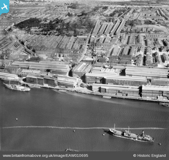
EAW010695 ENGLAND (1947). The Vickers-Armstrongs Ltd Elswick Works and environs, Elswick, 1947. This image was marked by Aerofilms Ltd for photo editing.
© Copyright OpenStreetMap contributors and licensed by the OpenStreetMap Foundation. 2026. Cartography is licensed as CC BY-SA.
Nearby Images (8)
EAW010695

EAW010712

EAW010714

EAW010702

EAW010694

EAW010696

EAW010715

EAW010713

Details
| Title | [EAW010695] The Vickers-Armstrongs Ltd Elswick Works and environs, Elswick, 1947. This image was marked by Aerofilms Ltd for photo editing. |
| Reference | EAW010695 |
| Date | 10-September-1947 |
| Link | |
| Place name | ELSWICK |
| Parish | |
| District | |
| Country | ENGLAND |
| Easting / Northing | 422631, 563125 |
| Longitude / Latitude | -1.6465142396883, 54.962165722501 |
| National Grid Reference | NZ226631 |
Pins

RupertHughes |
Tuesday 17th of November 2020 10:02:55 AM | |
|
redmist |
Monday 19th of October 2020 08:11:12 PM | |
|
redmist |
Monday 19th of October 2020 08:10:39 PM | |
|
redmist |
Monday 19th of October 2020 10:48:45 AM |