
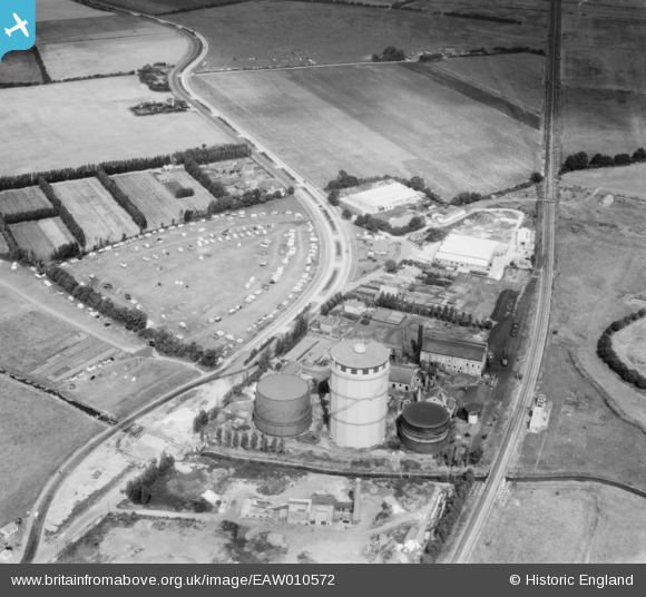
EAW010572 ENGLAND (1947). Bognor Regis Gas Works and caravan park adjacent to Shripney Road, South Bersted, 1947
© Copyright OpenStreetMap contributors and licensed by the OpenStreetMap Foundation. 2026. Cartography is licensed as CC BY-SA.
Nearby Images (10)
EAW010572

EAW010573

EAW010574

EAW010581

EAW010575

EAW010576

EAW010579

EAW010580

EAW010577

EAW010578

Details
| Title | [EAW010572] Bognor Regis Gas Works and caravan park adjacent to Shripney Road, South Bersted, 1947 |
| Reference | EAW010572 |
| Date | 3-September-1947 |
| Link | |
| Place name | SOUTH BERSTED |
| Parish | BERSTED |
| District | |
| Country | ENGLAND |
| Easting / Northing | 494116, 100764 |
| Longitude / Latitude | -0.66436725156818, 50.798221649487 |
| National Grid Reference | SU941008 |
Pins

Matt Aldred edob.mattaldred.com |
Thursday 11th of March 2021 04:30:26 PM | |

Sparky |
Wednesday 2nd of August 2017 10:22:55 PM | |
|
Sparky |
Wednesday 2nd of August 2017 10:21:41 PM | |
|
Sparky |
Wednesday 2nd of August 2017 10:21:13 PM | |

jrussill |
Tuesday 6th of January 2015 03:55:39 PM |
User Comment Contributions

WW2 Anti Tank Dragon's teeth |
jrussill |
Tuesday 6th of January 2015 03:57:15 PM |