
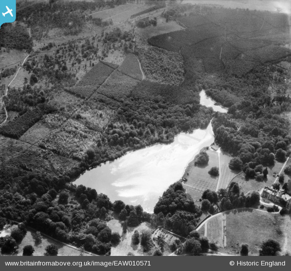
EAW010571 ENGLAND (1947). Tilgate Lake (Campbell's Lake) and surrounding forest, Tilgate, 1947
© Copyright OpenStreetMap contributors and licensed by the OpenStreetMap Foundation. 2026. Cartography is licensed as CC BY-SA.
Nearby Images (3)
EAW010571
 and surrounding forest, Tilgate, 1947")
EAW010568
 and surrounding forest and countryside, Tilgate, 1947")
EAW010570
 and surrounding forest and countryside, Tilgate, 1947")
Details
| Title | [EAW010571] Tilgate Lake (Campbell's Lake) and surrounding forest, Tilgate, 1947 |
| Reference | EAW010571 |
| Date | 3-September-1947 |
| Link | |
| Place name | TILGATE |
| Parish | |
| District | |
| Country | ENGLAND |
| Easting / Northing | 527994, 134350 |
| Longitude / Latitude | -0.17201226307677, 51.093626908617 |
| National Grid Reference | TQ280344 |
Pins

MB |
Tuesday 24th of December 2013 06:30:25 PM |