
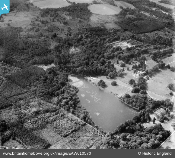
EAW010570 ENGLAND (1947). Tilgate Lake (Campbell's Lake) and surrounding forest and countryside, Tilgate, 1947
© Copyright OpenStreetMap contributors and licensed by the OpenStreetMap Foundation. 2026. Cartography is licensed as CC BY-SA.
Nearby Images (2)
EAW010570
 and surrounding forest and countryside, Tilgate, 1947")
EAW010571
 and surrounding forest, Tilgate, 1947")
Details
| Title | [EAW010570] Tilgate Lake (Campbell's Lake) and surrounding forest and countryside, Tilgate, 1947 |
| Reference | EAW010570 |
| Date | 3-September-1947 |
| Link | |
| Place name | TILGATE |
| Parish | |
| District | |
| Country | ENGLAND |
| Easting / Northing | 527790, 134217 |
| Longitude / Latitude | -0.17497124328512, 51.09247693319 |
| National Grid Reference | TQ278342 |
Pins

Bob |
Thursday 14th of October 2021 11:59:14 PM |