
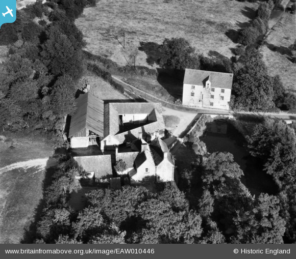
EAW010446 ENGLAND (1947). Kirklington Mill and Mill Farm, Kirklington, 1947
© Copyright OpenStreetMap contributors and licensed by the OpenStreetMap Foundation. 2026. Cartography is licensed as CC BY-SA.
Nearby Images (4)
EAW010446

EAW010445

EAW010443

EAW010444

Details
| Title | [EAW010446] Kirklington Mill and Mill Farm, Kirklington, 1947 |
| Reference | EAW010446 |
| Date | 30-August-1947 |
| Link | |
| Place name | KIRKLINGTON |
| Parish | KIRKLINGTON |
| District | |
| Country | ENGLAND |
| Easting / Northing | 467502, 357314 |
| Longitude / Latitude | -0.99152442007178, 53.108443747216 |
| National Grid Reference | SK675573 |
Pins
User Comment Contributions
The mill has an entry on the British Listed Buildings web site: www.britishlistedbuildings.co.uk/en-242177-kirklington-mill-and-road-bridge-kirklin |

MB |
Thursday 21st of November 2013 10:22:19 PM |