
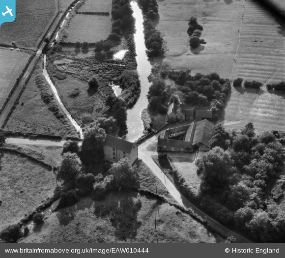
EAW010444 ENGLAND (1947). Kirklington Mill and Mill Farm, Kirklington, 1947
© Copyright OpenStreetMap contributors and licensed by the OpenStreetMap Foundation. 2026. Cartography is licensed as CC BY-SA.
Nearby Images (4)
EAW010444

EAW010443

EAW010445

EAW010446

Details
| Title | [EAW010444] Kirklington Mill and Mill Farm, Kirklington, 1947 |
| Reference | EAW010444 |
| Date | 30-August-1947 |
| Link | |
| Place name | KIRKLINGTON |
| Parish | KIRKLINGTON |
| District | |
| Country | ENGLAND |
| Easting / Northing | 467486, 357302 |
| Longitude / Latitude | -0.99176594151035, 53.108337907795 |
| National Grid Reference | SK675573 |
Pins
Be the first to add a comment to this image!