
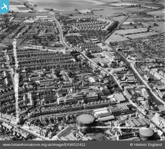
EAW010411 ENGLAND (1947). Genatosan Ltd Works, Derby Road and environs, Loughborough, 1947. This image was marked by Aerofilms Ltd for photo editing.
© Copyright OpenStreetMap contributors and licensed by the OpenStreetMap Foundation. 2026. Cartography is licensed as CC BY-SA.
Nearby Images (6)
EAW010411

EAW010409

EAW010412
 and the former Derby Road Railway Station, Loughborough, 1947.")
EAW010408

EPW057739

EAW010410

Details
| Title | [EAW010411] Genatosan Ltd Works, Derby Road and environs, Loughborough, 1947. This image was marked by Aerofilms Ltd for photo editing. |
| Reference | EAW010411 |
| Date | 30-August-1947 |
| Link | |
| Place name | LOUGHBOROUGH |
| Parish | |
| District | |
| Country | ENGLAND |
| Easting / Northing | 453123, 320027 |
| Longitude / Latitude | -1.2124308288923, 52.774880060888 |
| National Grid Reference | SK531200 |
