
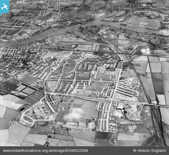
EAW010288 ENGLAND (1947). Development around Billy Mill and West Chirton, Billy Mill, from the north, 1947
© Copyright OpenStreetMap contributors and licensed by the OpenStreetMap Foundation. 2026. Cartography is licensed as CC BY-SA.
Nearby Images (5)
EAW010288

EAW010287

EAW010280

EAW010294

EAW010286

Details
| Title | [EAW010288] Development around Billy Mill and West Chirton, Billy Mill, from the north, 1947 |
| Reference | EAW010288 |
| Date | 24-August-1947 |
| Link | |
| Place name | BILLY MILL |
| Parish | |
| District | |
| Country | ENGLAND |
| Easting / Northing | 433449, 569046 |
| Longitude / Latitude | -1.4768570494966, 55.014768444404 |
| National Grid Reference | NZ334690 |
Pins
Be the first to add a comment to this image!