
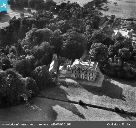
EAW010198 ENGLAND (1947). Winkburn Hall and the Church of St John of Jerusalem, Winkburn, 1947
© Copyright OpenStreetMap contributors and licensed by the OpenStreetMap Foundation. 2026. Cartography is licensed as CC BY-SA.
Nearby Images (9)
EAW010198

EAW010200

EAW010199

EAW010202

EAW010203

EAW010201

EAW010206

EAW010205

EAW010204

Details
| Title | [EAW010198] Winkburn Hall and the Church of St John of Jerusalem, Winkburn, 1947 |
| Reference | EAW010198 |
| Date | 29-August-1947 |
| Link | |
| Place name | WINKBURN |
| Parish | WINKBURN |
| District | |
| Country | ENGLAND |
| Easting / Northing | 471170, 358322 |
| Longitude / Latitude | -0.93651123804235, 53.117027374566 |
| National Grid Reference | SK712583 |
Pins
Be the first to add a comment to this image!