
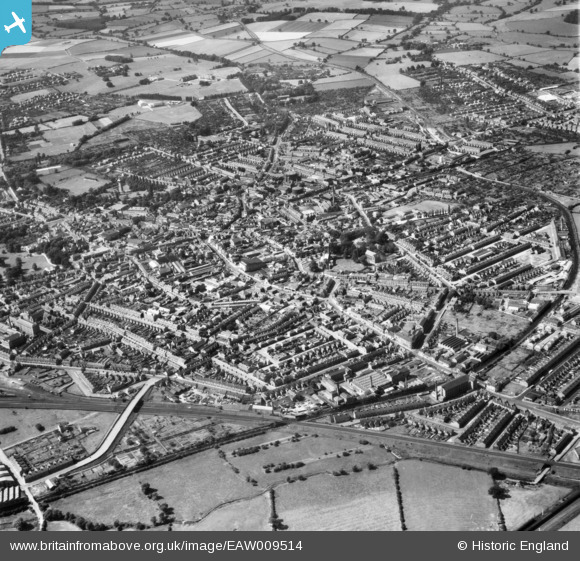
EAW009514 ENGLAND (1947). The town, Loughborough, from the east, 1947
© Copyright OpenStreetMap contributors and licensed by the OpenStreetMap Foundation. 2026. Cartography is licensed as CC BY-SA.
Nearby Images (5)
EAW009514

EPW057731

EPW008468

EPW008470

EPW008467

Details
| Title | [EAW009514] The town, Loughborough, from the east, 1947 |
| Reference | EAW009514 |
| Date | 18-August-1947 |
| Link | |
| Place name | LOUGHBOROUGH |
| Parish | |
| District | |
| Country | ENGLAND |
| Easting / Northing | 454320, 319950 |
| Longitude / Latitude | -1.1946995022621, 52.77406874432 |
| National Grid Reference | SK543200 |
Pins

Simon |
Saturday 28th of October 2023 07:00:14 PM | |
|
John W |
Saturday 7th of August 2021 06:29:24 PM | |
|
John W |
Saturday 7th of August 2021 06:28:48 PM | |
|
John W |
Saturday 7th of August 2021 06:14:24 PM | |
|
gBr |
Tuesday 21st of May 2019 12:14:56 AM | |
And once a Football League ground ! |
gerry-r |
Tuesday 8th of October 2024 02:24:23 PM |
|
Isleworth1961 |
Tuesday 27th of February 2018 10:28:24 PM | |

melgibbs |
Thursday 16th of January 2014 07:22:59 PM |