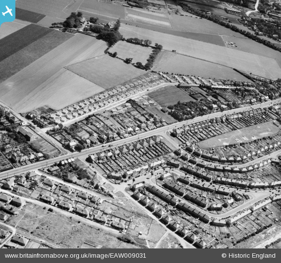
EAW009031 ENGLAND (1947). The residential area at Whitehall, Ramsgate, 1947
© Copyright OpenStreetMap contributors and licensed by the OpenStreetMap Foundation. 2025. Cartography is licensed as CC BY-SA.
Nearby Images (8)
Details
| Title | [EAW009031] The residential area at Whitehall, Ramsgate, 1947 |
| Reference | EAW009031 |
| Date | 12-August-1947 |
| Link | |
| Place name | RAMSGATE |
| Parish | RAMSGATE |
| District | |
| Country | ENGLAND |
| Easting / Northing | 637240, 166622 |
| Longitude / Latitude | 1.407306512608, 51.348569177466 |
| National Grid Reference | TR372666 |
Pins
Be the first to add a comment to this image!


![[EAW009031] The residential area at Whitehall, Ramsgate, 1947](http://britainfromabove.org.uk/sites/all/libraries/aerofilms-images/public/100x100/EAW/009/EAW009031.jpg)
![[EPW043751] Margate Road, Newlands Farm and surrounding countryside, Northwood, from the west, 1934](http://britainfromabove.org.uk/sites/all/libraries/aerofilms-images/public/100x100/EPW/043/EPW043751.jpg)
![[EAW009045] The residential area at Whitehall, Ramsgate, 1947](http://britainfromabove.org.uk/sites/all/libraries/aerofilms-images/public/100x100/EAW/009/EAW009045.jpg)
![[EAW009030] The residential area at Whitehall, Ramsgate, 1947](http://britainfromabove.org.uk/sites/all/libraries/aerofilms-images/public/100x100/EAW/009/EAW009030.jpg)
![[EAW009029] The residential area at Whitehall, Ramsgate, 1947](http://britainfromabove.org.uk/sites/all/libraries/aerofilms-images/public/100x100/EAW/009/EAW009029.jpg)
![[EPW043761] Margate Road, Pysons Road, Bromstone and environs, Northwood, from the south-west, 1934](http://britainfromabove.org.uk/sites/all/libraries/aerofilms-images/public/100x100/EPW/043/EPW043761.jpg)
![[EAW009044] The residential area at Whitehall, Ramsgate, 1947](http://britainfromabove.org.uk/sites/all/libraries/aerofilms-images/public/100x100/EAW/009/EAW009044.jpg)
![[EPW048856] Ramsgate Airport and environs, Ramsgate, from the south-west, 1935](http://britainfromabove.org.uk/sites/all/libraries/aerofilms-images/public/100x100/EPW/048/EPW048856.jpg)