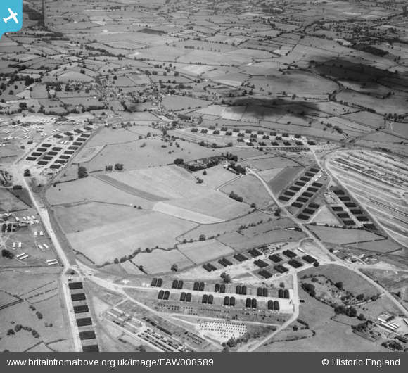
EAW008589 ENGLAND (1947). Marchington Camp, Marchington, 1947
© Copyright OpenStreetMap contributors and licensed by the OpenStreetMap Foundation. 2026. Cartography is licensed as CC BY-SA.
Nearby Images (7)
Details
| Title | [EAW008589] Marchington Camp, Marchington, 1947 |
| Reference | EAW008589 |
| Date | 27-July-1947 |
| Link | |
| Place name | MARCHINGTON |
| Parish | MARCHINGTON |
| District | |
| Country | ENGLAND |
| Easting / Northing | 414206, 330238 |
| Longitude / Latitude | -1.7889361014313, 52.869108173044 |
| National Grid Reference | SK142302 |
Pins

Matt Aldred edob.mattaldred.com |
Friday 8th of March 2024 03:56:03 PM | |

Matt Aldred edob.mattaldred.com |
Tuesday 22nd of February 2022 08:56:21 PM | |

Matt Aldred edob.mattaldred.com |
Tuesday 22nd of February 2022 08:52:55 PM | |

Graham Yaxley |
Wednesday 25th of March 2015 10:12:00 PM | |
Lynda Tubbs |
Tuesday 19th of November 2013 12:03:17 PM | |

Maurice |
Tuesday 19th of November 2013 07:39:54 AM | |

ontheedgeofmaddness |
Monday 18th of November 2013 07:24:14 PM |


![[EAW008589] Marchington Camp, Marchington, 1947](http://britainfromabove.org.uk/sites/all/libraries/aerofilms-images/public/100x100/EAW/008/EAW008589.jpg)
![[EAW008587] Marchington Camp, Marchington, 1947](http://britainfromabove.org.uk/sites/all/libraries/aerofilms-images/public/100x100/EAW/008/EAW008587.jpg)
![[EAW008586] Houndhill Manor and Farm, Marchington, 1947](http://britainfromabove.org.uk/sites/all/libraries/aerofilms-images/public/100x100/EAW/008/EAW008586.jpg)
![[EAW008585] Houndhill Manor, Marchington, 1947](http://britainfromabove.org.uk/sites/all/libraries/aerofilms-images/public/100x100/EAW/008/EAW008585.jpg)
![[EAW008584] Houndhill Manor, Marchington, 1947](http://britainfromabove.org.uk/sites/all/libraries/aerofilms-images/public/100x100/EAW/008/EAW008584.jpg)
![[EAW008588] Marchington Camp, Marchington, 1947](http://britainfromabove.org.uk/sites/all/libraries/aerofilms-images/public/100x100/EAW/008/EAW008588.jpg)
![[EAW008590] Marchington Camp, Marchington, 1947](http://britainfromabove.org.uk/sites/all/libraries/aerofilms-images/public/100x100/EAW/008/EAW008590.jpg)