
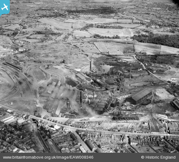
EAW008346 ENGLAND (1947). Round Oak Iron and Steel Works, Brierley Hill, 1947
© Copyright OpenStreetMap contributors and licensed by the OpenStreetMap Foundation. 2026. Cartography is licensed as CC BY-SA.
Nearby Images (20)
EAW008346

EAW008341

EAW008347

EAW008350

EAW008351

EAW008349

EAW008342

EAW008339

EAW008345

EAW008344

EAW008348

EAW038832

EAW038825

EAW038827

EAW008338

EAW008343

EAW038830

EAW038831

EAW038824

EAW038833

Details
| Title | [EAW008346] Round Oak Iron and Steel Works, Brierley Hill, 1947 |
| Reference | EAW008346 |
| Date | 20-July-1947 |
| Link | |
| Place name | BRIERLEY HILL |
| Parish | |
| District | |
| Country | ENGLAND |
| Easting / Northing | 392316, 287715 |
| Longitude / Latitude | -2.1131719963316, 52.486929800371 |
| National Grid Reference | SO923877 |
Pins
Be the first to add a comment to this image!