
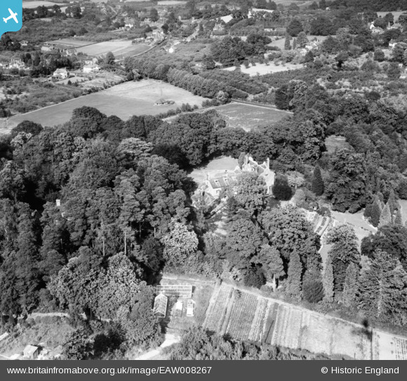
EAW008267 ENGLAND (1947). Oldbury Place, Ightham, 1947
© Copyright OpenStreetMap contributors and licensed by the OpenStreetMap Foundation. 2026. Cartography is licensed as CC BY-SA.
Nearby Images (10)
EAW008267

EAW008260

EAW008269

EAW008262

EAW008266

EAW008261

EAW008264

EAW008268

EAW008263

EAW008265

Details
| Title | [EAW008267] Oldbury Place, Ightham, 1947 |
| Reference | EAW008267 |
| Date | 15-July-1947 |
| Link | |
| Place name | IGHTHAM |
| Parish | IGHTHAM |
| District | |
| Country | ENGLAND |
| Easting / Northing | 558783, 156260 |
| Longitude / Latitude | 0.27706296412637, 51.282809728454 |
| National Grid Reference | TQ588563 |
Pins
Be the first to add a comment to this image!