
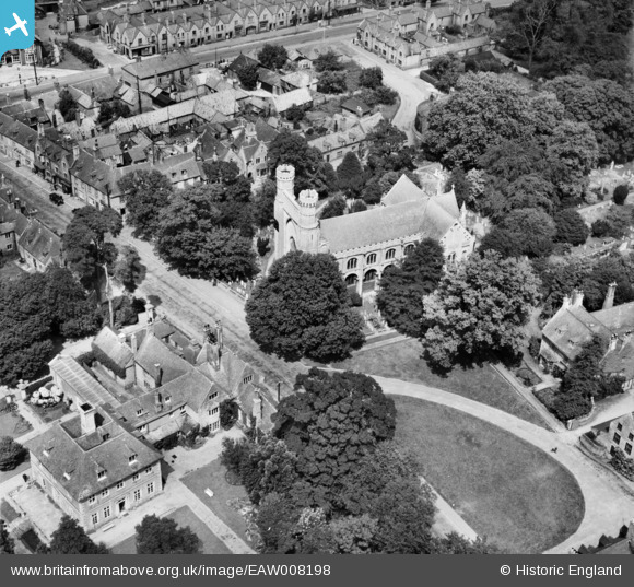
EAW008198 ENGLAND (1947). The Church of St Mary and St Botolph and environs, Thorney, 1947
© Copyright OpenStreetMap contributors and licensed by the OpenStreetMap Foundation. 2026. Cartography is licensed as CC BY-SA.
Nearby Images (7)
EAW008198

EAW008194

EAW008192

EAW008197

EAW008195

EAW008193

EAW008196

Details
| Title | [EAW008198] The Church of St Mary and St Botolph and environs, Thorney, 1947 |
| Reference | EAW008198 |
| Date | 12-July-1947 |
| Link | |
| Place name | THORNEY |
| Parish | THORNEY |
| District | |
| Country | ENGLAND |
| Easting / Northing | 528216, 304189 |
| Longitude / Latitude | -0.1057911717219, 52.619955534001 |
| National Grid Reference | TF282042 |
Pins
Be the first to add a comment to this image!