
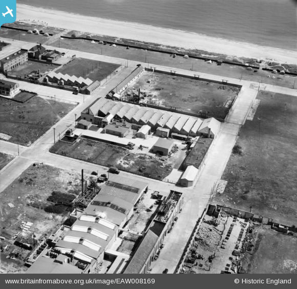
EAW008169 ENGLAND (1947). Factories between Bloomfield Road and Beevor Road, Great Yarmouth, 1947
© Copyright OpenStreetMap contributors and licensed by the OpenStreetMap Foundation. 2026. Cartography is licensed as CC BY-SA.
Nearby Images (33)
EAW008169

EAW008164

EAW008165

EAW047610

EAW027510

EAW047608

EAW047616

EAW027504

EAW047611

EAW027505

EAW008162

EAW027507

EAW027502

EAW047612

EAW027503

EAW008170

EAW047614

EAW008160

EAW027508

EAW027506

EAW047609

EAW047615

EAW047613

EAW008159

EAW008161

EAW027501

EAW027509

EAW008163

EAW008158

EAW008171

EPW021183

EAW008167

EAW008168

Details
| Title | [EAW008169] Factories between Bloomfield Road and Beevor Road, Great Yarmouth, 1947 |
| Reference | EAW008169 |
| Date | 12-July-1947 |
| Link | |
| Place name | GREAT YARMOUTH |
| Parish | |
| District | |
| Country | ENGLAND |
| Easting / Northing | 652990, 305329 |
| Longitude / Latitude | 1.7352273713038, 52.586423743716 |
| National Grid Reference | TG530053 |
Pins

redmist |
Tuesday 18th of January 2022 08:17:19 PM |