
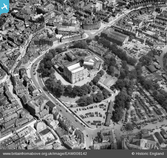
EAW008142 ENGLAND (1947). Norwich Castle, Norwich, 1947
© Copyright OpenStreetMap contributors and licensed by the OpenStreetMap Foundation. 2026. Cartography is licensed as CC BY-SA.
Nearby Images (25)
EAW008142

EAW024400

EAW008137

EAW036845

EAW037289

EAW008140

EAW008138

EPW001766

EAW024399

EAW002886

EAW008139

EAW008141

EPW021203

EAW002893

EAW037291

EAW008200

EAW002895

EPW021212

EPW001970A

EAW037292

EAW036848

EAW036846

EAW037290

EAW001994

EPW001970

Details
| Title | [EAW008142] Norwich Castle, Norwich, 1947 |
| Reference | EAW008142 |
| Date | 12-July-1947 |
| Link | |
| Place name | NORWICH |
| Parish | |
| District | |
| Country | ENGLAND |
| Easting / Northing | 623155, 308489 |
| Longitude / Latitude | 1.297711727089, 52.627852815636 |
| National Grid Reference | TG232085 |
Pins
Be the first to add a comment to this image!