
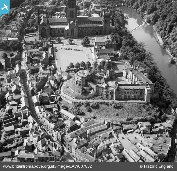
EAW007832 ENGLAND (1947). The Castle and Palace Green, Durham, 1947
© Copyright OpenStreetMap contributors and licensed by the OpenStreetMap Foundation. 2026. Cartography is licensed as CC BY-SA.
Nearby Images (23)
EAW007832

EPW026649

EAW014481

EPW026648

EAW014480

EAW005523

EAW005522

EPW026650

EPW026647

EPW026591

EAW005525

EAW005520

EAW017412

EAW014482

EAW017421

EAW007838

EPW016377

EPW016378

EAW014484

EAW007839

EAW007837

EAW005524

EAW017465

Details
| Title | [EAW007832] The Castle and Palace Green, Durham, 1947 |
| Reference | EAW007832 |
| Date | 27-June-1947 |
| Link | |
| Place name | DURHAM |
| Parish | |
| District | |
| Country | ENGLAND |
| Easting / Northing | 427391, 542369 |
| Longitude / Latitude | -1.5741380282024, 54.775389319065 |
| National Grid Reference | NZ274424 |
Pins

Class31 |
Thursday 8th of May 2014 08:33:48 PM |