
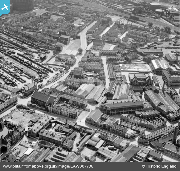
EAW007736 ENGLAND (1947). Houses and factories around Unity Street and Jubilee Street, Bristol, 1947
© Copyright OpenStreetMap contributors and licensed by the OpenStreetMap Foundation. 2026. Cartography is licensed as CC BY-SA.
Nearby Images (11)
EAW007736

EAW007732

EAW007737

EAW007735

EAW007733

EAW007738

EAW007731

EAW007734

EAW007739

EAW007740

EAW007741

Details
| Title | [EAW007736] Houses and factories around Unity Street and Jubilee Street, Bristol, 1947 |
| Reference | EAW007736 |
| Date | 22-June-1947 |
| Link | |
| Place name | BRISTOL |
| Parish | |
| District | |
| Country | ENGLAND |
| Easting / Northing | 359867, 172990 |
| Longitude / Latitude | -2.5776552332611, 51.453978474809 |
| National Grid Reference | ST599730 |
Pins

MB |
Tuesday 30th of August 2016 08:55:05 AM |