
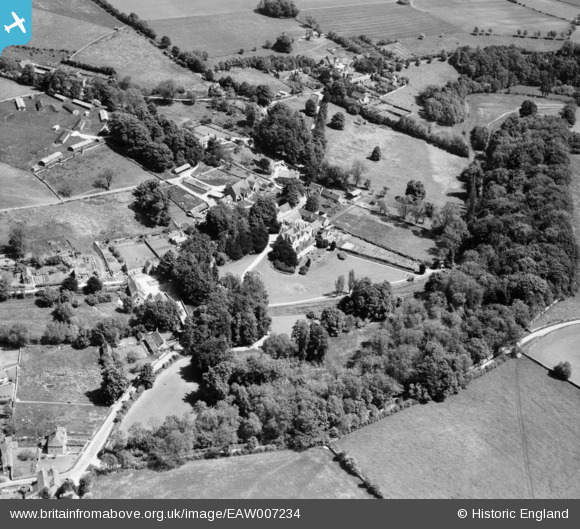
EAW007234 ENGLAND (1947). Ablington Manor and the village, Ablington, 1947
© Copyright OpenStreetMap contributors and licensed by the OpenStreetMap Foundation. 2026. Cartography is licensed as CC BY-SA.
Nearby Images (8)
EAW007234

EAW007231

EAW007236

EAW007237

EAW007233

EAW007232

EAW007238

EAW007235

Details
| Title | [EAW007234] Ablington Manor and the village, Ablington, 1947 |
| Reference | EAW007234 |
| Date | 24-June-1947 |
| Link | |
| Place name | ABLINGTON |
| Parish | BIBURY |
| District | |
| Country | ENGLAND |
| Easting / Northing | 410347, 207601 |
| Longitude / Latitude | -1.8500444441535, 51.76653950201 |
| National Grid Reference | SP103076 |
Pins
Be the first to add a comment to this image!